Wheaton Ecogeomorphology & Topographic Analysis Lab @ Fluvial Habitats Center
  • Home
    • Fluvial Habitats Center
    • Wheaton et al (Lab)
    • Bouwes ELR Lab
    • News & Annoucements
    • New FHC Publications
    • FHC Location
    • FHC Factsheets & Posters
    • Contact
  • People
    • People in the Lab... Coming & Going
    • Graduate Students >
      • Lauren Herbine
      • Karen Bartelt
    • Research Staff >
      • Research Scientists >
        • Joe Wheaton
        • Nicolaas Bouwes
        • Wally Macfarlane
        • Stephen Bennett
      • Technicians >
        • Cashe Rasmussen
        • Chalese Hafen
        • Dylan Baum >
          • Brian Ferrara
    • Where are they now? >
      • Former Graduate Students >
        • Sara Bangen
        • Reid Camp
        • Florence Consolati
        • Daniel Hamill
        • Konrad Hafen
        • James Hensleigh
        • Nate Hough-Snee
        • Alan Kasprak
        • Martha Jensen
        • Ryan Lokteff
        • Connor Penrod
        • Rebecca Rossi
        • Sonya Welsh
      • Research Scientists >
        • Sara Bangen
        • James Hensleigh
        • Natalie Kramer
        • Pete McHugh
        • Elijah Portugal
        • Carl Saunders
        • Eric Wall
        • Gary O'Brien
      • Post-Docs >
        • Nicole Czarnomski
      • Technicians >
        • Micael Albonico
        • Braden Anderson
        • Adan Banda
        • Jordan Burningham
        • Kenny Demeurichy
        • Taylor Dudunake
        • Martha Jensen
        • Joshua Gilbert
        • Jordan Gilbert
        • Thomas Hafen
        • Landon Haycock
        • Matt Meier
        • Chris Smith
        • Geoff Stevens
      • Visiting Scholars >
        • Ester Ramos
  • FHC Projects
    • Current Projects >
      • Beaver Dam Censusing
      • Birch Creek Restoration
      • Escalante Watershed
      • BRAT 2018-2019 >
        • BRAT-Yakama
        • BRAT-John Day
        • BRAT-NF Burnt River
        • BRAT-Idaho
        • BRAT-Utah
        • BRAT-TNC
        • BRAT-GYA
        • Survey123
      • ELR: Asotin LWD Restoration and IMW
      • Price River Channel Analysis
    • Past Projects >
      • BLM >
        • BLM: Historic Sand Cliff Signatures Public Archeology Program
      • DOE: ICRRR >
        • DOE/ICRRR: Geomorphic Change Detection 4.0 Software Development
        • DOE/ICRRR: Geomorphic Change Detection in the Grand Canyon
        • DOE/ICRRR: MoRPHED PhD Studentship
      • Idaho Power Company >
        • Idaho Power: TLS Data Analysis
      • ELR >
        • ELR/BPA: CHaMP Grand Ronde Crew Variability Study
        • ELR/BPA: ISEMP Lemhi Topographic Survey Technique Intercomparison
        • ELR/BPA: ISEMP Bridge Creek Restoration & IMW
        • ELR/FHC/CTWS: Pine Creek Beaver Assisted Restoration Pilot Project
      • NSF >
        • NSF: zCloudTools: Making Point Clouds Useful for Earth Science
        • NSF: Sensitivity of Braided River Morphodynamics to Sediment Supply
      • UDWR >
        • UDWR: Beaver Restoration Assessment Tool (BRAT)
      • USFS >
        • USFS Classification of Columbia River Basin Riparian Vegetation
        • USFS: Comparison of Traditional Versus Ground-Based LiDaR Instream Haibtat Assessments
        • USFS: Temple Fork Watershed Fish & Beaver Ecology
      • USGS >
        • USGS: Big Rivers Monitoring Protocol Development
        • USGS: Dynamism and Persistence of Eddy Sand Bars in Grand Canyon
        • USGS: Riparian Vegetation Analysis
        • USGS: Support in Geographic and Geomorphic Information Analysis for the Colorado River in Grand Canyon
      • Other Sponsors (one off) >
        • BPA/SFR: Development of CHaMP Transformation Tool
        • GCT: Pilot Study: Testing the Beaver Restoration Assessment Tool (BRAT)
        • NOAA: Linking Fisheries,
        • NPS: Assessment of Indicator Sites
        • USU: Tracking Ecogeomorphic Dynamics in Beaver Dam Complexes
    • Study Site Pages >
      • Bridge Creek >
        • 2009 BDSS Structures
        • Bridge Creek April 2010 Drone Survey
      • River Feshie >
        • The River Feshie Catchment
        • Our Research
        • The Team
        • Posters, Papers, & More
        • Photo Gallery
  • Resources
    • ETAL Reading Group >
      • ETAL Reading Group Zotero Library
    • Courses & Workshops >
      • Courses & Workshops by Joe
    • Guides & Tips >
      • Figure Preparation Tutorials
      • Basic Computing Tips & Tricks >
        • Database & SQL Intro
        • Batch Unzip Script
        • Get a QR Code
        • GeoJSON
        • Markdown
        • Special Characters
        • USU VPN
      • GIS Help >
        • ArcGIS Education Edition
        • GIS Data Sources >
          • Connecting To The APFO Services
          • Connecting to the Utah AGRC Discover Imagery and Base Map Server
          • High Resolution Imagery for Utah State
      • How to Use Specific Software >
        • Adobe Illustrator >
          • Making GCD Figures for ET-AL Lab Using ArcGIS & Adobe Illustrator
        • ArcGIS Desktop - ArcMap >
          • GIS Tutorials
          • Creating DEMs, TINs and Terrains
          • How to divide polylines into a specified segment length
          • Simple Change Detection in ArcGIS
          • Working with Styles in ArcGIS
          • Fixing ActiveX Warning in ArcGIS 10.5
        • Box >
          • Migrating to Box Drive from Box Sync
        • EndNote >
          • EndNote X4 Basics
        • FastStone Capture
        • GitHub >
          • Make a GitHub Account
        • Picasa >
          • Geotagging images & making albums
        • Word >
          • Saving Word Documents as PDFs
          • Using Styles Effectively in Manuscripts & Reports
        • Zotero >
          • Adding from Browser
          • Cite-While-you-Write >
            • Citing in Google Docs
            • Cite in Word
      • Reccomended Software & Utilities
      • Surveying & Geomatics >
        • rtkGPS
      • Writing Resources >
        • Writing Literature Reviews (for Grads)
        • Writing Scientific Papers
        • Uploading Content to Research Gate
    • Lab Members Only >
      • Internal Resources >
        • When you First Start
        • Standard Software Suite
        • Lab Software License
        • Virtual Computing
        • Editing Workshop Flyers & Webpages
        • Travel
        • Vignettes
      • Internal FHC Announcements
      • FHC Workshops
      • ETAL Projects on Box
      • ETAL Non Project on Box
    • River Links >
      • Classification Schemes >
        • Eco-Geo-Hydro Mess
      • Free Literature
      • Rivers in the News
      • Videos & Galleries
  • Joe Wheaton

New FHC, ET-AL or ELR Publications

Gravel Bed Rivers Chapter on 'Revisiting the Morphological Approach' finally out!

3/1/2018

0 Comments

 
Picture
Back in 2015, Damia Vericat, James Brasington and Joe put together a chapter reviewing the morphological approach to estimating sediment transport from repeat topographic surveys. There was a surprising lack of examples in the literature of the method being used in the recent literature or high resolution topographic surveys being exploited for this purpose. We review the various ways the approach can be implemented and show some examples. 

  • 2017. Vericat D, Wheaton JM and Brasington J. Revisiting the Morphological Approach, Gravel-Bed Rivers. John Wiley & Sons, Ltd, pp. 121-158. DOI:  10.1002/9781118971437.ch5. (see Damia's talk here)
Picture
Originally posted May 18, 2017, 3:41 PM by Joe Wheaton
0 Comments

State of Science Paper in ESPL lays out an agenda and framework for using mechanistic ecohydraulic models to inform salmonid life cycle models across at a population scale.

3/1/2018

1 Comment

 
Picture
In this ambitious State of the Science article we lay out a pragmatic method for realizing the vision Fausch et al. (2002) spelt out over 15 years ago. Many years of geomorphology and ecohydraulic research at the reach-scale has led to better mechanistic understanding of the drivers of fish habitat. However, little of this research has been directly tied across entire riverscapes to assess the significance of fish habitat on actual fish populations. We lay out a framework, using the wealth of data from Columbia Habitat Monitoring Program (CHaMP) to connect the dots and upscale this understanding across entire drainage networks.  In McHugh et al. (2017) we present a case study of how this is actually done. In Wheaton et al. (2017), we illustrate and describe conceptually how to leverage various advances that have been made in isolation in the fields of remote sensing, ecohydraulics, network modelling and life cycle modelling to take things a step further and answer some fundamental questions about fish populations of major societal and management relevance.

  1. 2017. Wheaton J, Bouwes N, McHugh P, Saunders WC, Bangen SG, Bailey PE, Nahorniak M, Wall CE and Jordan C. Upscaling Site-Scale Ecohydraulic Models to Inform Salmonid Population-Level Life Cycle Modelling and Restoration Actions – Lessons from the Columbia River Basin. Earth Surface Processes and Landforms. DOI: 10.1002/esp.4137
References:
  • Fausch, KD, Torgersen, CE, Baxter, CV and Li, HW, 2002. Landscapes to riverscapes: Bridging the gap between research and conservation of stream fishes. Bioscience, 52(6): 483-498. DOI: 10.1641/0006-3568(2002)052[0483:ltrbtg]2.0.co;2.
  • 2017. McHugh P, Saunders C, Bouwes N, Wall E, Bangen S, Wheaton J, Nahorniak M, Ruzycki J, Tattam I and Jordan C.  Linking models across scales  to assess the viability and restoration potential of a threatened population of steelhead (Oncorhynchus mykiss) in the Middle Fork John Day River, Oregon, USA. Ecological Modelling, 355: pp 24-38.  DOI: 10.1016/j.ecolmodel.2017.03.022.

Originally posted May 17, 2017, 5:35 PM by Joe Wheat
1 Comment

Paper by McHugh et al. (2017) shows how life cycle models can be used to assess restoration alternatives

3/1/2018

0 Comments

 
Picture
Pete McHugh and Carl Saunders led this effort in the Middle Fork John Day to demonstrate how site scale NREI models (e.g. Wall et al, 2016) to inform network scale models to produce fish population capacity estimates that can drive life cycle models. They then use this approach to produce realistic restoration scenarios to see what sort of capacity increases might be produced by various restoration alternatives and what (if any) population level impact this may have. This framework and vision was laid out conceptually in Wheaton et al. (2017), and this case study application and the online supplement provide many of the methodological details for how to pull it together. The McHugh et al. (2017) paper was just published in Ecological Modelling.
  • 2017. McHugh P, Saunders C, Bouwes N, Wall E, Bangen S, Wheaton J, Nahorniak M, Ruzycki J, Tattam I and Jordan C.  Linking models across scales  to assess the viability and restoration potential of a threatened population of steelhead (Oncorhynchus mykiss) in the Middle Fork John Day River, Oregon, USA. Ecological Modelling, 355: pp 24-38.  DOI: 10.1016/j.ecolmodel.2017.03.022.
References:
  1. 2016. Wall E, Bouwes N, Wheaton JM, Bennett SN, Saunders WC, McHugh PA, and Jordan CE. Design and monitoring of woody structures and their benefits to juvenile steelhead trout (Oncorhynchus mykiss) using a net rate of energy intake model. Canadian Journal of Fisheries and Aquatic Sciences. DOI: 10.1139/cjfas-2016-0131.
  2. 2017. Wheaton J, Bouwes N, McHugh P, Saunders WC, Bangen SG, Bailey PE, Nahorniak M, Wall CE and Jordan C. Upscaling Site-Scale Ecohydraulic Models to Inform Salmonid Population-Level Life Cycle Modelling and Restoration Actions – Lessons from the Columbia River Basin. Earth Surface Processes and Landforms. DOI: 10.1002/esp.4137​

Originally posted May 17, 2017, 5:17 PM by Joe Wheaton
0 Comments

New Article on Temperature Impacts of BDAs

3/1/2018

0 Comments

 
Picture
Nick Weber led an effort to publish findings from the Bridge Creek beaver restoration project on impacts of beaver dam analogues (BDAs) on summer stream temperatures. The Weber et al. (2017) paper was just published in PLOSone.

  • 2017. Weber N, Bouwes N, Pollock M, Volk C,  Wheaton JM, Wathen G, and Jordan C. Alteration of stream temperature by natural and artificial beaver dams. PLOS ONE. 12(5): e0176313. DOI: 10.1371/journal.pone.0176313

Originally posted May 17, 2017, 5:06 PM by Joe Wheaton
0 Comments

River Styles Assessment of Middle Fork John Day Published in Journal of Maps

3/1/2018

0 Comments

 
Picture
Gary O'Brien led this effort with collaborators Kirstie Fryirs and Gary Brierley. In this Journal of Maps article, we show how a geomorphic assessment using River Styles can be used to inform watershed restoration planning and prioritization:
  • O’Brien, GR, Wheaton, J, Fryirs, K, McHugh, P, Bouwes, N, Brierley, G and Jordan, C, 2017. A geomorphic assessment to inform strategic stream restoration planning in the Middle Fork John Day Watershed, Oregon, USA. Journal of Maps, 13(2): 369-381.DOI: 10.1080/17445647.2017.1313787.
  • See here for Atlas​

Picture
Originally posted Apr 23, 2017, 6:42 PM by Joe Wheaton
0 Comments

Simple method for estimating water storage in beaver ponds

3/1/2018

0 Comments

 
Picture
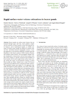
Daniel Karran (a PhD student of Cherie Westbrook at University of Saskatchewan) led an effort to test how well simple methods for estimating surface water storage volume from just surface area and dam height works for beaver ponds. The methods have been used widely in estimating storage in wetlands and prairie pot-holes, and provide a nice morphometric approach to estimating dams from area (easy to measure off aerial imagery) and dam height, which can be quickly measured in the field. This allows foregoing the effort of full topographic surveys to estimate pond volumes.  Given the growing interest in beaver as a restoration and climate adaptation tool, methods for quickly estimating their impact on hydrology (in this case through increasing surface water storage) are very topical. 

  • Karran, DJ, Westbrook, CJ, Wheaton, JM, Johnston, CA and Bedard-Haughn, A, 2017. Rapid surface-water volume estimations in beaver ponds. Hydrol. Earth Syst. Sci., 21(2): 1039-1050. DOI: 10.5194/hess-21-1039-2017.

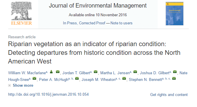
Originally posted Feb 20, 2017, 1:31 PM by Joe Wheaton
0 Comments

New manuscript: Riparian vegetation as an indicator of riparian condition

3/1/2018

0 Comments

 
Picture
This manuscript presents a flexible approach to assessing riparian vegetation departure from historic condition. In this case study, LANDFIRE data was used to assess riparian condition across the entire state of Utah and twelve watersheds in the Columbia River Basin:
  • Macfarlane, W.W., J.T. Gilbert, M.L. Jensen, J.D. Gilbert, N. Hough-Snee, P.A. McHugh, J.M. Wheaton, S.N. Bennett. In Press. Riparian vegetation as an indicator of riparian condition: detecting departures from historic condition across the North American West. Journal of Environmental Management. DOI: 10.1016/j.jenvman.2016.10.054
Links:
  • Journal of Environmental Management
  • Google Scholar
  • Researchgate
  • Perceptible Changes

Picture
Picture
Originally posted Nov 22, 2016, 10:09 AM by Wally Macfarlane
0 Comments

The Valley Bottom Extraction Tool (V-BET)

3/1/2018

0 Comments

 
Our paper, "The Valley Bottom Extraction Tool (V-BET): a GIS tool for delineating valley bottoms across entire drainage networks" was recently published in the journal Computers & Geosciences.  The paper presents the V-BET tool, explains how it works and presents an application of valley bottom delineation for the state of Utah and several basins within the interior Columbia River Basin.
Picture
http://www.sciencedirect.com/science/article/pii/S0098300416301935

The V-BET tool can be downloaded at https://bitbucket.org/jtgilbert/riparian-condition-assessment-tools/wiki/Home
Originally posted Sep 7, 2016, 9:21 AM by Jordan Gilbert
0 Comments

Is high-resolution vegetation mapping a valuable stream restoration tool ?

3/1/2018

0 Comments

 
Picture
Picture
https://www.researchgate.net/publication/307560726_High-resolution_riparian_vegetation_mapping_to_prioritize_conservation_and_restoration_in_an_impaired_desert_river
Originally posted Sep 1, 2016, 4:26 PM by Wally Macfarlane
0 Comments

A Comparison of Stream Channel Classification Frameworks published in PLOS ONE

3/1/2018

0 Comments

 
Alan Kasprak and Nate Hough-Snee recently led a team of FHC researchers and research partners in an effort to compare stream classification networks within Oregon’s Middle Fork John Day River Basin. This much-anticipated research explores both the agreement and disagreement between the River Styles Framework, Rosgen Classification, Natural Channel Classification, and a statistical classification at a suite of CHaMP sites. The paper is available on Research Gate or PLOS ONE.

Kasprak A, Hough-Snee N, Beechie T, Bouwes N, Brierley G, Camp R, Fryirs K., Imaki H, Jensen M, O'Brien G, Rosgen D, Wheaton JM (2016). The Blurred Line between Form and Process: A Comparison of Stream Channel Classification Frameworks. PLoS ONE 11(3): e0150293. doi:10.1371/journal.pone.0150293

A summary of the paper is available on Alan Kasprak’s blog and on Nate Hough Snee’s Perceptible Changes blog. See also this news post.

Picture
Picture
Originally posted Mar 17, 2016, 11:51 AM by Martha Jensen
0 Comments
<<Previous

    Author

    Write something about yourself. No need to be fancy, just an overview.

    Archives

    September 2018
    March 2018
    February 2018

    Categories

    All

    RSS Feed

Picture
Picture
Picture
Picture
Picture
This work is licensed under a
​ 
Creative Commons Attribution 4.0 International License.
  • Home
    • Fluvial Habitats Center
    • Wheaton et al (Lab)
    • Bouwes ELR Lab
    • News & Annoucements
    • New FHC Publications
    • FHC Location
    • FHC Factsheets & Posters
    • Contact
  • People
    • People in the Lab... Coming & Going
    • Graduate Students >
      • Lauren Herbine
      • Karen Bartelt
    • Research Staff >
      • Research Scientists >
        • Joe Wheaton
        • Nicolaas Bouwes
        • Wally Macfarlane
        • Stephen Bennett
      • Technicians >
        • Cashe Rasmussen
        • Chalese Hafen
        • Dylan Baum >
          • Brian Ferrara
    • Where are they now? >
      • Former Graduate Students >
        • Sara Bangen
        • Reid Camp
        • Florence Consolati
        • Daniel Hamill
        • Konrad Hafen
        • James Hensleigh
        • Nate Hough-Snee
        • Alan Kasprak
        • Martha Jensen
        • Ryan Lokteff
        • Connor Penrod
        • Rebecca Rossi
        • Sonya Welsh
      • Research Scientists >
        • Sara Bangen
        • James Hensleigh
        • Natalie Kramer
        • Pete McHugh
        • Elijah Portugal
        • Carl Saunders
        • Eric Wall
        • Gary O'Brien
      • Post-Docs >
        • Nicole Czarnomski
      • Technicians >
        • Micael Albonico
        • Braden Anderson
        • Adan Banda
        • Jordan Burningham
        • Kenny Demeurichy
        • Taylor Dudunake
        • Martha Jensen
        • Joshua Gilbert
        • Jordan Gilbert
        • Thomas Hafen
        • Landon Haycock
        • Matt Meier
        • Chris Smith
        • Geoff Stevens
      • Visiting Scholars >
        • Ester Ramos
  • FHC Projects
    • Current Projects >
      • Beaver Dam Censusing
      • Birch Creek Restoration
      • Escalante Watershed
      • BRAT 2018-2019 >
        • BRAT-Yakama
        • BRAT-John Day
        • BRAT-NF Burnt River
        • BRAT-Idaho
        • BRAT-Utah
        • BRAT-TNC
        • BRAT-GYA
        • Survey123
      • ELR: Asotin LWD Restoration and IMW
      • Price River Channel Analysis
    • Past Projects >
      • BLM >
        • BLM: Historic Sand Cliff Signatures Public Archeology Program
      • DOE: ICRRR >
        • DOE/ICRRR: Geomorphic Change Detection 4.0 Software Development
        • DOE/ICRRR: Geomorphic Change Detection in the Grand Canyon
        • DOE/ICRRR: MoRPHED PhD Studentship
      • Idaho Power Company >
        • Idaho Power: TLS Data Analysis
      • ELR >
        • ELR/BPA: CHaMP Grand Ronde Crew Variability Study
        • ELR/BPA: ISEMP Lemhi Topographic Survey Technique Intercomparison
        • ELR/BPA: ISEMP Bridge Creek Restoration & IMW
        • ELR/FHC/CTWS: Pine Creek Beaver Assisted Restoration Pilot Project
      • NSF >
        • NSF: zCloudTools: Making Point Clouds Useful for Earth Science
        • NSF: Sensitivity of Braided River Morphodynamics to Sediment Supply
      • UDWR >
        • UDWR: Beaver Restoration Assessment Tool (BRAT)
      • USFS >
        • USFS Classification of Columbia River Basin Riparian Vegetation
        • USFS: Comparison of Traditional Versus Ground-Based LiDaR Instream Haibtat Assessments
        • USFS: Temple Fork Watershed Fish & Beaver Ecology
      • USGS >
        • USGS: Big Rivers Monitoring Protocol Development
        • USGS: Dynamism and Persistence of Eddy Sand Bars in Grand Canyon
        • USGS: Riparian Vegetation Analysis
        • USGS: Support in Geographic and Geomorphic Information Analysis for the Colorado River in Grand Canyon
      • Other Sponsors (one off) >
        • BPA/SFR: Development of CHaMP Transformation Tool
        • GCT: Pilot Study: Testing the Beaver Restoration Assessment Tool (BRAT)
        • NOAA: Linking Fisheries,
        • NPS: Assessment of Indicator Sites
        • USU: Tracking Ecogeomorphic Dynamics in Beaver Dam Complexes
    • Study Site Pages >
      • Bridge Creek >
        • 2009 BDSS Structures
        • Bridge Creek April 2010 Drone Survey
      • River Feshie >
        • The River Feshie Catchment
        • Our Research
        • The Team
        • Posters, Papers, & More
        • Photo Gallery
  • Resources
    • ETAL Reading Group >
      • ETAL Reading Group Zotero Library
    • Courses & Workshops >
      • Courses & Workshops by Joe
    • Guides & Tips >
      • Figure Preparation Tutorials
      • Basic Computing Tips & Tricks >
        • Database & SQL Intro
        • Batch Unzip Script
        • Get a QR Code
        • GeoJSON
        • Markdown
        • Special Characters
        • USU VPN
      • GIS Help >
        • ArcGIS Education Edition
        • GIS Data Sources >
          • Connecting To The APFO Services
          • Connecting to the Utah AGRC Discover Imagery and Base Map Server
          • High Resolution Imagery for Utah State
      • How to Use Specific Software >
        • Adobe Illustrator >
          • Making GCD Figures for ET-AL Lab Using ArcGIS & Adobe Illustrator
        • ArcGIS Desktop - ArcMap >
          • GIS Tutorials
          • Creating DEMs, TINs and Terrains
          • How to divide polylines into a specified segment length
          • Simple Change Detection in ArcGIS
          • Working with Styles in ArcGIS
          • Fixing ActiveX Warning in ArcGIS 10.5
        • Box >
          • Migrating to Box Drive from Box Sync
        • EndNote >
          • EndNote X4 Basics
        • FastStone Capture
        • GitHub >
          • Make a GitHub Account
        • Picasa >
          • Geotagging images & making albums
        • Word >
          • Saving Word Documents as PDFs
          • Using Styles Effectively in Manuscripts & Reports
        • Zotero >
          • Adding from Browser
          • Cite-While-you-Write >
            • Citing in Google Docs
            • Cite in Word
      • Reccomended Software & Utilities
      • Surveying & Geomatics >
        • rtkGPS
      • Writing Resources >
        • Writing Literature Reviews (for Grads)
        • Writing Scientific Papers
        • Uploading Content to Research Gate
    • Lab Members Only >
      • Internal Resources >
        • When you First Start
        • Standard Software Suite
        • Lab Software License
        • Virtual Computing
        • Editing Workshop Flyers & Webpages
        • Travel
        • Vignettes
      • Internal FHC Announcements
      • FHC Workshops
      • ETAL Projects on Box
      • ETAL Non Project on Box
    • River Links >
      • Classification Schemes >
        • Eco-Geo-Hydro Mess
      • Free Literature
      • Rivers in the News
      • Videos & Galleries
  • Joe Wheaton