Wheaton Ecogeomorphology & Topographic Analysis Lab @ Fluvial Habitats Center
  • Home
    • Fluvial Habitats Center
    • Wheaton et al (Lab)
    • Bouwes ELR Lab
    • News & Annoucements
    • New FHC Publications
    • FHC Location
    • FHC Factsheets & Posters
    • Contact
  • People
    • People in the Lab... Coming & Going
    • Graduate Students >
      • Lauren Herbine
      • Karen Bartelt
    • Research Staff >
      • Research Scientists >
        • Joe Wheaton
        • Nicolaas Bouwes
        • Wally Macfarlane
        • Stephen Bennett
      • Technicians >
        • Cashe Rasmussen
        • Chalese Hafen
        • Dylan Baum >
          • Brian Ferrara
    • Where are they now? >
      • Former Graduate Students >
        • Sara Bangen
        • Reid Camp
        • Florence Consolati
        • Daniel Hamill
        • Konrad Hafen
        • James Hensleigh
        • Nate Hough-Snee
        • Alan Kasprak
        • Martha Jensen
        • Ryan Lokteff
        • Connor Penrod
        • Rebecca Rossi
        • Sonya Welsh
      • Research Scientists >
        • Sara Bangen
        • James Hensleigh
        • Natalie Kramer
        • Pete McHugh
        • Elijah Portugal
        • Carl Saunders
        • Eric Wall
        • Gary O'Brien
      • Post-Docs >
        • Nicole Czarnomski
      • Technicians >
        • Micael Albonico
        • Braden Anderson
        • Adan Banda
        • Jordan Burningham
        • Kenny Demeurichy
        • Taylor Dudunake
        • Martha Jensen
        • Joshua Gilbert
        • Jordan Gilbert
        • Thomas Hafen
        • Landon Haycock
        • Matt Meier
        • Chris Smith
        • Geoff Stevens
      • Visiting Scholars >
        • Ester Ramos
  • FHC Projects
    • Current Projects >
      • Beaver Dam Censusing
      • Birch Creek Restoration
      • Escalante Watershed
      • BRAT 2018-2019 >
        • BRAT-Yakama
        • BRAT-John Day
        • BRAT-NF Burnt River
        • BRAT-Idaho
        • BRAT-Utah
        • BRAT-TNC
        • BRAT-GYA
        • Survey123
      • ELR: Asotin LWD Restoration and IMW
      • Price River Channel Analysis
    • Past Projects >
      • BLM >
        • BLM: Historic Sand Cliff Signatures Public Archeology Program
      • DOE: ICRRR >
        • DOE/ICRRR: Geomorphic Change Detection 4.0 Software Development
        • DOE/ICRRR: Geomorphic Change Detection in the Grand Canyon
        • DOE/ICRRR: MoRPHED PhD Studentship
      • Idaho Power Company >
        • Idaho Power: TLS Data Analysis
      • ELR >
        • ELR/BPA: CHaMP Grand Ronde Crew Variability Study
        • ELR/BPA: ISEMP Lemhi Topographic Survey Technique Intercomparison
        • ELR/BPA: ISEMP Bridge Creek Restoration & IMW
        • ELR/FHC/CTWS: Pine Creek Beaver Assisted Restoration Pilot Project
      • NSF >
        • NSF: zCloudTools: Making Point Clouds Useful for Earth Science
        • NSF: Sensitivity of Braided River Morphodynamics to Sediment Supply
      • UDWR >
        • UDWR: Beaver Restoration Assessment Tool (BRAT)
      • USFS >
        • USFS Classification of Columbia River Basin Riparian Vegetation
        • USFS: Comparison of Traditional Versus Ground-Based LiDaR Instream Haibtat Assessments
        • USFS: Temple Fork Watershed Fish & Beaver Ecology
      • USGS >
        • USGS: Big Rivers Monitoring Protocol Development
        • USGS: Dynamism and Persistence of Eddy Sand Bars in Grand Canyon
        • USGS: Riparian Vegetation Analysis
        • USGS: Support in Geographic and Geomorphic Information Analysis for the Colorado River in Grand Canyon
      • Other Sponsors (one off) >
        • BPA/SFR: Development of CHaMP Transformation Tool
        • GCT: Pilot Study: Testing the Beaver Restoration Assessment Tool (BRAT)
        • NOAA: Linking Fisheries,
        • NPS: Assessment of Indicator Sites
        • USU: Tracking Ecogeomorphic Dynamics in Beaver Dam Complexes
    • Study Site Pages >
      • Bridge Creek >
        • 2009 BDSS Structures
        • Bridge Creek April 2010 Drone Survey
      • River Feshie >
        • The River Feshie Catchment
        • Our Research
        • The Team
        • Posters, Papers, & More
        • Photo Gallery
  • Resources
    • ETAL Reading Group >
      • ETAL Reading Group Zotero Library
    • Courses & Workshops >
      • Courses & Workshops by Joe
    • Guides & Tips >
      • Figure Preparation Tutorials
      • Basic Computing Tips & Tricks >
        • Database & SQL Intro
        • Batch Unzip Script
        • Get a QR Code
        • GeoJSON
        • Markdown
        • Special Characters
        • USU VPN
      • GIS Help >
        • ArcGIS Education Edition
        • GIS Data Sources >
          • Connecting To The APFO Services
          • Connecting to the Utah AGRC Discover Imagery and Base Map Server
          • High Resolution Imagery for Utah State
      • How to Use Specific Software >
        • Adobe Illustrator >
          • Making GCD Figures for ET-AL Lab Using ArcGIS & Adobe Illustrator
        • ArcGIS Desktop - ArcMap >
          • GIS Tutorials
          • Creating DEMs, TINs and Terrains
          • How to divide polylines into a specified segment length
          • Simple Change Detection in ArcGIS
          • Working with Styles in ArcGIS
          • Fixing ActiveX Warning in ArcGIS 10.5
        • Box >
          • Migrating to Box Drive from Box Sync
        • EndNote >
          • EndNote X4 Basics
        • FastStone Capture
        • GitHub >
          • Make a GitHub Account
        • Picasa >
          • Geotagging images & making albums
        • Word >
          • Saving Word Documents as PDFs
          • Using Styles Effectively in Manuscripts & Reports
        • Zotero >
          • Adding from Browser
          • Cite-While-you-Write >
            • Citing in Google Docs
            • Cite in Word
      • Reccomended Software & Utilities
      • Surveying & Geomatics >
        • rtkGPS
      • Writing Resources >
        • Writing Literature Reviews (for Grads)
        • Writing Scientific Papers
        • Uploading Content to Research Gate
    • Lab Members Only >
      • Internal Resources >
        • When you First Start
        • Standard Software Suite
        • Lab Software License
        • Virtual Computing
        • Editing Workshop Flyers & Webpages
        • Travel
        • Vignettes
      • Internal FHC Announcements
      • FHC Workshops
      • ETAL Projects on Box
      • ETAL Non Project on Box
    • River Links >
      • Classification Schemes >
        • Eco-Geo-Hydro Mess
      • Free Literature
      • Rivers in the News
      • Videos & Galleries
  • Joe Wheaton

News

ET-AL Graduate Students Publish Stream Classification Synthesis - UPR & USU Today Pick Up Story

2/17/2018

0 Comments

 
Picture
A team of ET-AL former and current graduate students (Kasprak, Hough-Snee, Camp & Jensen) decided to take a class project in a River Styles short course to compare various stream classification approaches to a whole new level. They published their findings in PLOS-One this week and Utah Public Radio and USU Today both picked up the story.
  • Kasprak A, Hough-Snee N, Beechie T, Bouwes N, Brierley G, Camp R, Fryirs K., Imaki H, Jensen M, O'Brien G, Rosgen D, Wheaton JM (2016). The Blurred Line between Form and Process: A Comparison of Stream Channel Classification Frameworks. PLoS ONE 11(3): e0150293. doi:10.1371/journal.pone.0150293
What is neat about this contribution is a team of USU WATS graduate students led an effort to bring together some of the world´s leading experts on issues of stream classification and river management who have been on very different sides of a sometimes hostile debate. These students managed to point out the common ground among the different perspectives and provide a constructive, and meaningful scientific contribution from some co-authors that I am sure most in our discipline would have never predicted would find a unified message, much less write a paper together. All this as an extra-curricular, side project spurred from a class they took together here at Utah State. Pretty cool.

Originally posted Mar 19, 2016, 2:05 PM by Joe Wheaton
0 Comments

Business Insider picks up on IMWs . . . and Steve

2/17/2018

0 Comments

 
Picture
An AP article from Business Insider give a brief overview of salmon restoration work in the PNW. Specifically focusing on IMWs. Bridge Creek gets a mention, and Steve Bennett has a memorable quote:"It's OK if natural beavers join in on the fun," said Stephen Bennett, a research associate of watershed sciences at Utah State University who is involved with that and other studies." The article was in response to a pair of recent papers on Intensively Managed Watersheds and Adaptive Management led by Steve Bennett and just published in last month's episode of Fisheries Magazine. 

  • Bouwes, N., et al. (2016). "Adapting Adaptive Management for Testing the Effectiveness of Stream Restoration: An Intensively Monitored Watershed Example." Fisheries 41(2): 84-91.
  • Bennett, S., et al. (2016). "Progress and challenges of testing the effectiveness of stream restoration in the Pacific Northwest using Intensively Monitored Watersheds." Fisheries 41(2): 92-103.

Originally posted Feb 11, 2016, 11:29 AM by Konrad Hafen
0 Comments

The Media Just Cant Get Enough of Those Walmart Beaver!

2/17/2018

0 Comments

 
On Saturday January 23rd, Elijah Portugal from the FHC was interviewed again by Jennifer Pemberton from Utah Public Radio's excellent program on water issues in Utah, The Source. The short (~5 mins) follow up interview was in regards to the Walmart beaver mitigation project, where Elijah filled Jennifer in on the current developments at the Walmart beaver ponds since last April when the original interview was conducted. In summary, we successfully installed two pond levelers upstream of the two main beaver dams within the wetland area in Spet (2106) to control flooding, and the devices have been successfully working since then. We also used fencing and abrasive paint to prevent the unwanted harvest of ~6 trees. Many thanks again to Jennifer pemberton from The Source and everyone else that made this project a success!


Here is a link to the follow-up interview: http://upr.org/post/source-year-water-review ​
Originally posted Feb 1, 2016, 10:47 AM by Elijah Portugal 
0 Comments

FHC/ELR Beaver Mitigation Project with Walmart Makes Headlines

2/17/2018

0 Comments

 
Picture
The FHC , ELR , and Anabranch Solutions have been working for the past year with Dan Miller from the Bear River Watershed Council, to help the South Logan Walmart and the City of Logan develop an adaptive beaver management plan.  The plan by Portugal et al. (2015) is quite simple - instead of relying on traditional approaches of lethal control to mitigate the potential flooding and tree harvesting impacts of beaver, it proposes simple 'living with beaver' strategies.  The plan draws on long-standing techniques of 'living with beaver mitigation strategies' (e.g. Beaver Solutions), and codifies potential actions to different scenarios in to a simple, common sense approach to mitigating the nuisance problems beaver pose.


The efforts culminated on October 12 in the installation of a couple of pond levelers. Much to our surprise, this relatively small side project we undertook as a volunteer effort garnered significant media attention. Below is a partial listing of some of the media outlets that picked up the story. FHC's Nick Bouwes, Elijah Portugal and Scott Shahverdian are all featured. 
  • Portugal E., Wheaton, JM., Bouwes, N. 2015. Spring Creek Wetland Area Adaptive Beaver Management Plan. Prepared for Walmart Stores Inc. and the City of Logan. Logan, Utah. 25 Pages. DOI: 10.13140/RG.2.1.2075.3361


TV Coverage
  • KSL-TV News: Oct. 12, 2015; 5 pm broadcast, John Hollenhorst:  Project helps protect Logan beavers, reduce threat of flooding
  • ABC 4 Utah TV News: Oct. 12, 2015: Walmart, Utah agencies address beaver pond problems

Picture
Radio Coverage


Utah Public Radio: April 24, 2015, Jennifer Pemberton: The Source: For Rivers and Streams Messiness Matters. - Scroll down to Shopping Cart Habitat


Picture
Picture
Print & Digital Media Coverage
  • Utah State Today, October 22, 2015. Mary-Ann Muffoletto: USU Scientists Lead Innovative Wetlands Effort with Beavers, Walmart
  • PHYS.ORG, October 15, 2015. Ecologists enlist beavers, walmart in wetlands conservation effort
  • Deseret News,  October 12, 2015. John Hollenhorst:  Project helps protect beavers, reduce threat of flooding
  • Washington Times, October 18, 2015. Associated Press: Logan project slows flooding to protect beavers
  • Cache Valley Daily,  October 16, 2015. Ecologists enlist beavers, Walmart in wetlands conservation effort
  • Herald Journal, October 15, 2015. Kevin Opsahl:  Building with beavers: Pond project allows commerce, wildlife to coexist
  • Hard News Cafe, October 19, 2015. Amanda Wray: Scientists help Walmart manage pond, battle beavers to stop flooding
  • Martinez Beavers.org, October 16, 2015. Heidi Perryman: Utah has a Deep Bench
​
For more information, see also our Beaver Workshop pages.

Originally posted Oct 30, 2015, 9:41 AM by Joe Wheaton
0 Comments

Beaver: Back to the Future video now online!

2/17/2018

0 Comments

 
Picture
The Grand Canyon Trust has just released a new 13-minute video “Beaver: Back to the Future,” featuring ET AL's own Nick Bouwes. It also includes four Forest Service employees, and a retired Regional Forester who praise the power of beaver to beneficially restore and manage national forest water flows in the face of climate change.

Filmmaker Sarah Koenigsberg’s camera captures three processes by which beaver have recently been able to re-enter creek systems in Utah, Oregon, and Washington to work their dam magic.
​

Originally posted Sep 28, 2015, 1:53 PM by Jeannine Huenemann
0 Comments

The end of an era: Kasprak to defend Ph.D dissertation

2/17/2018

0 Comments

 
​Mark your calendars: Alan Kasprak will be defending his dissertation Friday September 4th.
Picture
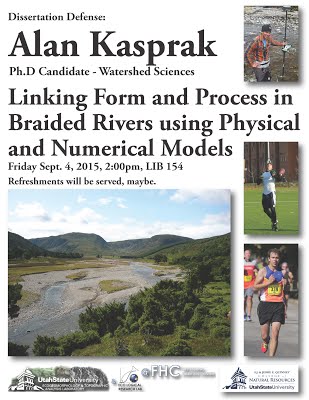
Originally posted Aug 18, 2015, 11:17 AM by Nate Hough-Snee
0 Comments

New ‘Structure-from-Motion’ Sandbar Surveying Method used by Youth Citizen Scientists in Grand Canyon National Park

2/17/2018

0 Comments

 
“participating in citizen science has widen my perspective and understanding 
of Grand Canyon and why it is vital to protect it.”

                                                                           -Grand Canyon Youth Participant
Picture
Youth citizen scientists collect images and ground control data with 'structure-from-motion' sandbar surveying method
Earlier this summer, Utah State University graduate student Becca Rossi rafted and surveyed sandbar topography along the Colorado River with a group of youth citizen scientists from the Grand Canyon Youth program. Her team for this trip consisted of 24 youth, 2 youth coordinators, 6 river guides, and 2 other scientists.

During the two weeks of surveying, the group rafted over 225 river miles of canyons in the Grand Canyon National Park (GCNP) to collect data. Both USU and the Grand Canyon Monitoring and Research Center (GCMRC) will use this data to monitor and record changes in size and stability of sandbar deposits along the Colorado River downstream of Glen Canyon Dam. Sandbars provide habitat for terrestrial and aquatic species, campsites for river rafters and scientists, and an aeolian sediment source for the preservation of archaeological sites.
Picture
Sandbar at river mile 119R in Grand Canyon providing campsite area and riparian habitat
The Glen Canyon Dam Adaptive Management Program has monitored sandbar depletion for more than twenty years through GCMRC. Annual topographic monitoring has focused on sandbar response to high flow experiments (HFEs) released from Glen Canyon Dam at 45 sites throughout GCNP. The Paria and Little Colorado Rivers are the two main sand sources downstream of the dam. With enough monsoonal rain, tributary sand is stored on the channel bed and is then mobilized downstream by the HFEs. These environmental flows aim to maintain and build sandbars within GCNP. Annual monitoring campaigns survey sandbar topography using a total station setup and repeatable control network.

There are roughly 500 large sandbars distributed over the 225 miles of the Colorado river throughout GCNP. The question remains, if the 45 sandbar monitoring sites are representative of the total sediment budget in response to the modified 

dam operations.
Picture
Map* of the Colorado River downstream of Glen Canyon Dam with locations of the 45 annual sandbar monitoring sites (red triangles).
Sandbar site extension provides an option to test the representation of the 45 monitoring sites, but is costly and time-consuming with the current surveying method. 'Structure-from-motion' photogrammetry (SfM) is a new surveying method that will potentially provide a cheaper and faster way to extend the topographic sandbar survey in GCNP. The method consists of collecting overlapping, oblique imagery with consumer grade cameras mounted on 16 ft poles. To ensure repeatability of the survey, 10-50 ground control points are surveyed across the sandbar surface with a total station. Post-processing of the data consists of creating 3D models of the surface topography using robust pixel-matching algorithms.
Picture
Top pane shows blue rectangles that represent the location and orientation of images collected 16 feet above the sandbar surface. Bottom pane shows the dense point cloud reconstruction, located at river mile 8L in Marble Canyon (boats at lower right are 18 ft in length).
The youth citizen scientists collected data at 12 different sandbar sites distributed across Marble and Grand Canyons. Images were taken every 10-15 feet along upstream, downstream, and circular transects on the sandbar surface. Repeat surveys were used to test the variability in camera angle and image spacing between youth crews. While in the field, youth were able to see 3D visualizations of the sandbars they surveyed with the SfM software Agisoft Photoscan Professional. The youth also collected ground control point data with the help of a surveyor, and handheld images from across, behind, and in front of the sandbars.
Picture
Youth collecting images with pole mounted camera at river mile 41R in Marble Canyon
In addition to teaching the youth emerging scientific survey methods, Becca’s research goals included teaching them about fluvial geomorphology in Grand Canyon, and the impacts of Glen Canyon dam on the downstream environment. She also hopes to evaluate the feasibility of using citizen science in future monitoring of sandbars. This is the second of three field work trips that Becca will conduct in GCNP during her time at USU to develop and implement a SfM surveying protocol. 

One of the youth on the trip said “participating in citizen science has widen my perspective and understanding of Grand Canyon and why it is vital to protect it.” He especially enjoyed the scientists, saying that “they knew how to have fun and to get the projects done,” and that he “really enjoyed learning about the software that would create the beach models.” 

Becca is currently working on her Master’s degree in Watershed Sciences with Dr. Joseph Wheaton, Dr. Paul Grams (GCMRC), Dr. Daniel Buscombe (GCMRC), and Dr. Jack Schmidt (USU). At USU, she is specializing in fluvial geomorphology. This interest has brought her to USU and specifically the Colorado River downstream of Glen Canyon Dam where she is currently working on a thesis investigating sandbar dynamics in response to high flow experiments in Marble and Grand Canyons using emerging 'structure-from-motion' photogrammetry techniques. 

Of her experience, Becca says, “the public is often disconnected to science and its importance, and citizen science is a way to bridge this gap. Citizen science is especially important for protecting environments from negative anthropogenic impacts. This experience has not only aided the progress of developing an SfM surveying protocol, but has aided me to contextualize my research into the bigger picture of disseminating scientific knowledge to the public, and more importantly to youth.”

*Modified from Hazel et al. (2010).
Originally posted Jul 31, 2015, 1:06 PM by Rebecca Rossi
0 Comments

Beavers in the news

2/17/2018

0 Comments

 
Picture
A recent publication in Logan's Herald Journal - Bridgerland Edition on June 28, 2015 featured our favorite furry friend. The article, titled "As Busy as Beavers" was included in the Wild Things issue celebrating Cache Valley's living treasures. Nick Bouwes provided details on the work of the Fluvial Habitats Center, and projects between the south Walmart and the Bear River Watershed Council. He also said that a recent count conducted on the Logan River and Blacksmith Fork draining areas found over 1,100 beaver dams.

Originally posted Jul 14, 2015, 2:38 PM by Jeannine Huenemann 
0 Comments

Collaborative Beaver-Assisted Restoration Project on the San Rafael River

2/17/2018

0 Comments

 
Picture
View looking upstream from the mouth of Moonshine Wash, Lower San Rafael River
Like many desert rivers, the San Rafael River in Price County, Utah has become degraded largely through human-induced alteration of the natural hydrology by over-allocation of water. The magnitude and duration of spring snowmelt floods has been diminished since the early 1900s while monsoon floods continue to deposit large quantities of sediment within the channel, floodplain, and along the channel margins. The altered hydrograph has left the lower San Rafael River in a transport limited condition where the amount of sediment supplied to the channel exceeds the river's ability to transport the sediment out of the system. This dynamic, coupled with dense populations of invasive tamarisks along the channel margins and floodplain, has led to channel narrowing and vertical incision, leaving much of the lower San Rafael disconnected from its historic floodplain. The incised condition, along with the lack of floodplain connectivity, has degraded the quality of instream and riparian habitat leading to a reduction in native fish populations, and a lack of cottonwood and willow recruitment on the floodplain. 

A large collaborative restoration effort was developed with the primary restoration goals to: 1) improve native fish populations, specifically for three native fish species listed as sensitive species (e.g.,flannelmouth sucker (Catostomus latipinnis), the bluehead sucker (Catostomus discobolus), and the roundtail chub (Gila robusta)), 2) improve instream and riparian habitat and, 3) use adaptive management/experimental approach to restoration planning, implementation, and monitoring in order to learn as much as possible from this project to inform future restoration efforts on similar desert rivers. The project is a collaboration between the Bureau of Land Management, the Utah Division of Wildlife Resources, the United States Geological Survey, and Utah State University's Fish Ecology Lab, Fluvial Geomorphology Lab, the Utah Water Research Lab, and the Fluvial Habitat Center. The project consists of: 1) large-scale tamarisk removal from the banks and floodplain to allow for natural river migration and a transition to native riparian vegetation, 2) gravel augmentation to increase the complexity of instream habitat and learn about sediment transport dynamics within the lower San Rafael, 3) addition of boulders from the valley wall margins where the river naturally contacts the valley margin, and 3) use beaver and beaver dam analogs to improve instream and riparian habitat. 
Picture
Dr. Peter Wilcock, Sam Lyster, Brian Laub, and UDWR's Dan Keller inspect a breached natural beaver dam
Beaver are naturally present in the lower San Rafael River, but the narrow incised condition and lack of suitable riparian vegetation prevents their dams from persisting for very long and likely limits the size of their population. The developers of the restoration plan for the San Rafael River recognized the critical role that beaver have historically played in structuring and maintaining a healthy riverine system and wanted to 'Partner with Beaver' to restore physical and ecological processes within the lower San Rafael River. This project is the first of its kind to use Beaver Dam Analogs (BDAs) in a primarily sand-bedded desert river. The Fluvial Habitat Center was contracted to develop a large scale pilot restoration design to test the effectiveness of using BDAs to improve instream and riparian conditions and beaver habitat within the lower San Rafael River. Dr. Joe Wheaton, Dr. Nick Bouwes, Wally MacFarlane, and Elijah Portugal are responsible for conducting this project for the Fluvial Habitat Center. ​
Picture
Restoration implementation crew getting ready to build BDAs
For more information about the project see below:
  • The Restoration and Monitoring Plan for Native Fish and Riparian Vegetation on the San Rafael River (Laub et al.,  2013)
  • Application of Science-Based Restoration Planning to a Desert River System (Laub et al., 2015)
Picture
Building a BDA starter dam
Picture
BDA starter dam in process of construction
Picture
BDA starter dam downstream, not completely finished
Originally posted Jun 16, 2015, 2:51 PM by Jeannine Huenemann 
0 Comments

Partnering with Beaver in Restoration workshop

2/17/2018

0 Comments

 
Picture
Photo: Dam building at Blacksmith Fork River, courtesy of Jeremy Jensen
Utah Division of Wildlife Resources employees from around the state were in Logan, Utah on May 4 – 5 to participate in a Partnering with Beaver in Restoration workshop. During the workshop, participants worked with Dr. Joe Wheaton, along with Dr. Nick Bouwes, Wally MacFarlane, and Elijah Portugal, to visit Spawn Creek beaver dams, and build a dam on the Blacksmith Fork River.
Picture
Photo: Aerial, Spawn Creek Dam, courtesy of Jeremy Jensen
Originally posted Jun 16, 2015, 11:35 AM by Jeannine Huenemann
0 Comments
<<Previous

    AuthorS

    Contributions from ETAL lab members.

    Archives

    February 2018

    Categories

    All

    RSS Feed

Picture
Picture
Picture
Picture
Picture
This work is licensed under a
​ 
Creative Commons Attribution 4.0 International License.
  • Home
    • Fluvial Habitats Center
    • Wheaton et al (Lab)
    • Bouwes ELR Lab
    • News & Annoucements
    • New FHC Publications
    • FHC Location
    • FHC Factsheets & Posters
    • Contact
  • People
    • People in the Lab... Coming & Going
    • Graduate Students >
      • Lauren Herbine
      • Karen Bartelt
    • Research Staff >
      • Research Scientists >
        • Joe Wheaton
        • Nicolaas Bouwes
        • Wally Macfarlane
        • Stephen Bennett
      • Technicians >
        • Cashe Rasmussen
        • Chalese Hafen
        • Dylan Baum >
          • Brian Ferrara
    • Where are they now? >
      • Former Graduate Students >
        • Sara Bangen
        • Reid Camp
        • Florence Consolati
        • Daniel Hamill
        • Konrad Hafen
        • James Hensleigh
        • Nate Hough-Snee
        • Alan Kasprak
        • Martha Jensen
        • Ryan Lokteff
        • Connor Penrod
        • Rebecca Rossi
        • Sonya Welsh
      • Research Scientists >
        • Sara Bangen
        • James Hensleigh
        • Natalie Kramer
        • Pete McHugh
        • Elijah Portugal
        • Carl Saunders
        • Eric Wall
        • Gary O'Brien
      • Post-Docs >
        • Nicole Czarnomski
      • Technicians >
        • Micael Albonico
        • Braden Anderson
        • Adan Banda
        • Jordan Burningham
        • Kenny Demeurichy
        • Taylor Dudunake
        • Martha Jensen
        • Joshua Gilbert
        • Jordan Gilbert
        • Thomas Hafen
        • Landon Haycock
        • Matt Meier
        • Chris Smith
        • Geoff Stevens
      • Visiting Scholars >
        • Ester Ramos
  • FHC Projects
    • Current Projects >
      • Beaver Dam Censusing
      • Birch Creek Restoration
      • Escalante Watershed
      • BRAT 2018-2019 >
        • BRAT-Yakama
        • BRAT-John Day
        • BRAT-NF Burnt River
        • BRAT-Idaho
        • BRAT-Utah
        • BRAT-TNC
        • BRAT-GYA
        • Survey123
      • ELR: Asotin LWD Restoration and IMW
      • Price River Channel Analysis
    • Past Projects >
      • BLM >
        • BLM: Historic Sand Cliff Signatures Public Archeology Program
      • DOE: ICRRR >
        • DOE/ICRRR: Geomorphic Change Detection 4.0 Software Development
        • DOE/ICRRR: Geomorphic Change Detection in the Grand Canyon
        • DOE/ICRRR: MoRPHED PhD Studentship
      • Idaho Power Company >
        • Idaho Power: TLS Data Analysis
      • ELR >
        • ELR/BPA: CHaMP Grand Ronde Crew Variability Study
        • ELR/BPA: ISEMP Lemhi Topographic Survey Technique Intercomparison
        • ELR/BPA: ISEMP Bridge Creek Restoration & IMW
        • ELR/FHC/CTWS: Pine Creek Beaver Assisted Restoration Pilot Project
      • NSF >
        • NSF: zCloudTools: Making Point Clouds Useful for Earth Science
        • NSF: Sensitivity of Braided River Morphodynamics to Sediment Supply
      • UDWR >
        • UDWR: Beaver Restoration Assessment Tool (BRAT)
      • USFS >
        • USFS Classification of Columbia River Basin Riparian Vegetation
        • USFS: Comparison of Traditional Versus Ground-Based LiDaR Instream Haibtat Assessments
        • USFS: Temple Fork Watershed Fish & Beaver Ecology
      • USGS >
        • USGS: Big Rivers Monitoring Protocol Development
        • USGS: Dynamism and Persistence of Eddy Sand Bars in Grand Canyon
        • USGS: Riparian Vegetation Analysis
        • USGS: Support in Geographic and Geomorphic Information Analysis for the Colorado River in Grand Canyon
      • Other Sponsors (one off) >
        • BPA/SFR: Development of CHaMP Transformation Tool
        • GCT: Pilot Study: Testing the Beaver Restoration Assessment Tool (BRAT)
        • NOAA: Linking Fisheries,
        • NPS: Assessment of Indicator Sites
        • USU: Tracking Ecogeomorphic Dynamics in Beaver Dam Complexes
    • Study Site Pages >
      • Bridge Creek >
        • 2009 BDSS Structures
        • Bridge Creek April 2010 Drone Survey
      • River Feshie >
        • The River Feshie Catchment
        • Our Research
        • The Team
        • Posters, Papers, & More
        • Photo Gallery
  • Resources
    • ETAL Reading Group >
      • ETAL Reading Group Zotero Library
    • Courses & Workshops >
      • Courses & Workshops by Joe
    • Guides & Tips >
      • Figure Preparation Tutorials
      • Basic Computing Tips & Tricks >
        • Database & SQL Intro
        • Batch Unzip Script
        • Get a QR Code
        • GeoJSON
        • Markdown
        • Special Characters
        • USU VPN
      • GIS Help >
        • ArcGIS Education Edition
        • GIS Data Sources >
          • Connecting To The APFO Services
          • Connecting to the Utah AGRC Discover Imagery and Base Map Server
          • High Resolution Imagery for Utah State
      • How to Use Specific Software >
        • Adobe Illustrator >
          • Making GCD Figures for ET-AL Lab Using ArcGIS & Adobe Illustrator
        • ArcGIS Desktop - ArcMap >
          • GIS Tutorials
          • Creating DEMs, TINs and Terrains
          • How to divide polylines into a specified segment length
          • Simple Change Detection in ArcGIS
          • Working with Styles in ArcGIS
          • Fixing ActiveX Warning in ArcGIS 10.5
        • Box >
          • Migrating to Box Drive from Box Sync
        • EndNote >
          • EndNote X4 Basics
        • FastStone Capture
        • GitHub >
          • Make a GitHub Account
        • Picasa >
          • Geotagging images & making albums
        • Word >
          • Saving Word Documents as PDFs
          • Using Styles Effectively in Manuscripts & Reports
        • Zotero >
          • Adding from Browser
          • Cite-While-you-Write >
            • Citing in Google Docs
            • Cite in Word
      • Reccomended Software & Utilities
      • Surveying & Geomatics >
        • rtkGPS
      • Writing Resources >
        • Writing Literature Reviews (for Grads)
        • Writing Scientific Papers
        • Uploading Content to Research Gate
    • Lab Members Only >
      • Internal Resources >
        • When you First Start
        • Standard Software Suite
        • Lab Software License
        • Virtual Computing
        • Editing Workshop Flyers & Webpages
        • Travel
        • Vignettes
      • Internal FHC Announcements
      • FHC Workshops
      • ETAL Projects on Box
      • ETAL Non Project on Box
    • River Links >
      • Classification Schemes >
        • Eco-Geo-Hydro Mess
      • Free Literature
      • Rivers in the News
      • Videos & Galleries
  • Joe Wheaton